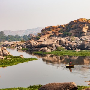
Finally I get to share the first part of our ultimate trip to South India.
Traveling South India is such a huge topic that I needed my own time to compile the first part, others will follow soon with all our beautiful impressions, useful tips and stunning stories.
Just to summarize it, the five of us, including my husband part of his family and myself, organized a road trip and traveled to South of India back in June for 12 days.
According to Google maps we moved around 2203 kilometers.
That's an impressive number!
Google apparently thinks that we traveled by car a total of 46 hours, or 1 day and 22 hours.
Let me tell you, don't believe Google's travel time suggestions, it's way more then that, in fact we took around 67 ½ hours!
Google maps doesn't consider the typical Indian road obstructions or incredible road conditions.
Nonetheless, without Google maps we would have had a difficult time and most probably we would have wasted more time searching for places.
The reason for that is because we rarely came across direction boards and if we did, they were not always in the Latin script, so reading them would have been impossible since South India is home to several Indian languages and different scripts.
So, Google maps is a great tool.
Even if you have no internet during the drive, don't panic.
Turn on the GPS before leaving for your trip and keep it turned on all the way long.
The GPS position is detailed and it will help you especially when you are crossing crazy, confusing and stuffed city center roads.
We only had 2 satellite interference problems and that was always around Ooty in the mountains.
If you are intending to take the same road trip (or any other road trip in India), check out this post, which will help you getting prepared. -> What you need to organize before you start your road trip
Anyway, I have embedded the map of India showing our exact route by car.
Quick road reference - Traveling South India
I wanted to share the roads we used so that you get to your destinations safely and quickly and I think naming the cities and towns (bold), which we passed, will help your orientation.
NH stands for national highway and SH for state highway.
I wish I had these directions back then when we visited this corner of the world.
Google maps can be clumsy and confusing if you don't have a reliable internet connection and at the time when we traveled, google maps could only save smaller areas and not special custom routes.
However I do believe that the google maps navigation in India will get better over time once more places are mapped properly.
The routes described further down might help you pick a better road, save you time or simply help plan properly.
Also, with my knowledge I might motivate you to take this adventure to discover beautiful places in India.
If you have knowledge to add up or to share, please feel free to leave us a comment at the end of this article, because your experience might be able to help others in the future.
Pick your route for your road trip across South India
Kochi to Goa via Calicut route
Goa to Mysore route
We started out from Goa, picked the NH 17 towards Karwar, passed Honnavar and changed to NH206 direction Sagar.
We continued along this highway passing Shivamogga and Bhadravati so to move on towards direction Mysore.
In Arsikere we changed to SH7, moved on to Channarayapattana and Srirangapatana, where we picked the road 17 directly to Mysore.
- The roads are in good to best condition.
- The Coastline highway until Honnavar resembles a regular road and there might be traffic.
- The Western ghat mountain highway from Honnavar to Sagar is another regular road but with many road turns. You will rarely encounter a village.
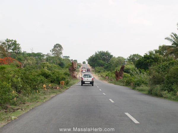
- From Sagar onwards to Mysor you will experience state of the art roads. Smooth, large and straight, these roads are decorated with big trees, and therefore I can say we had the best driving experience at this part of our tour.
- Once you cross the Western Ghats you will still experience hot weather but it's a bit drier.
- We took about 14 hours to drive the Goa to Mysore rout in good speed.
Mysore to Ooty route
From Mysore we moved towards South on the NH 212 until Gundlupet were we changed to the NH 67, passing two National Parks, before reaching Ooty.
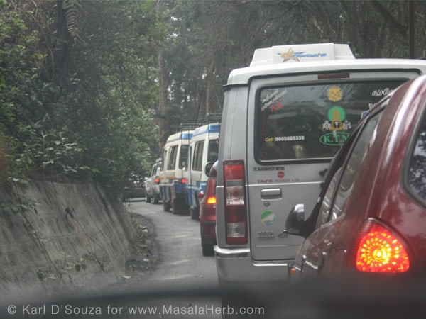
- The roads are in good condition at first. The mountain roads are quite tight and some Indian drivers are reckless so be prepared.
- The highway from Mysore city to around Gundlupet was smooth and quick.
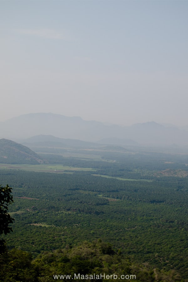
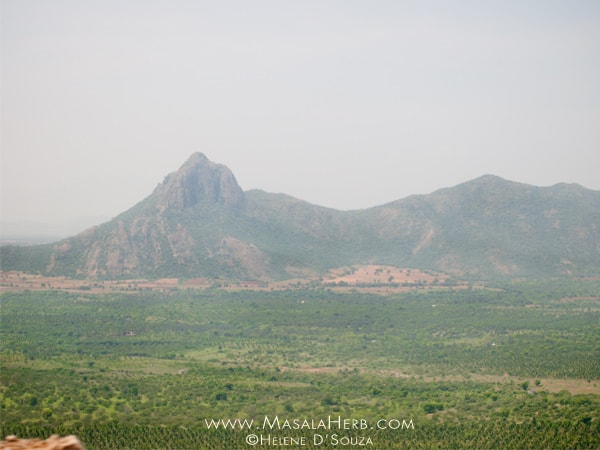
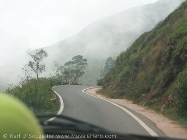
- After Gundlupet you will notice that the highway turns more into a regular mountain road, leading through the Western Ghats mountain range.
- You will be crossing the state boarder from Karnataka state to Tamil Nadu state
- Once you are in a height you will notice a change of climate, the weather will be much cooler and maybe a bit less humid.
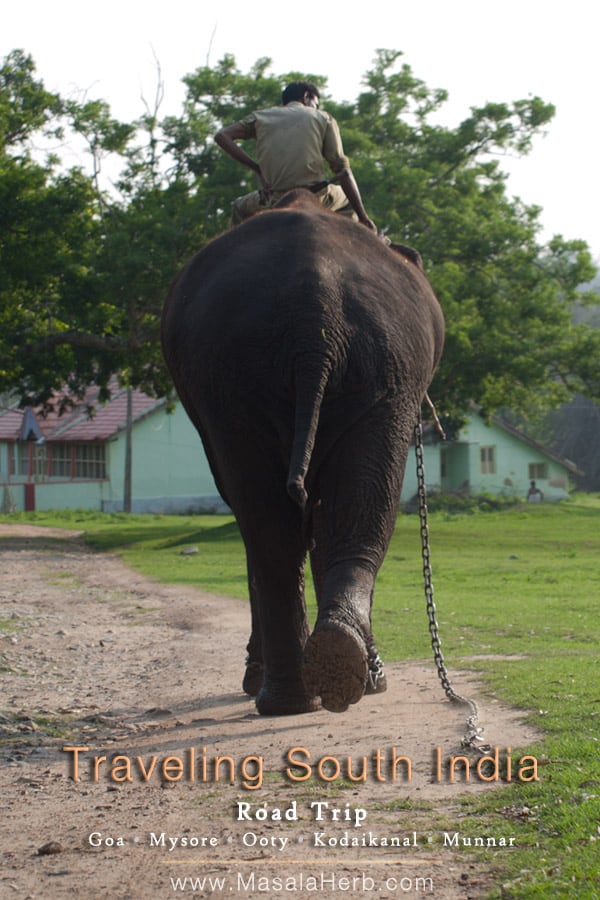
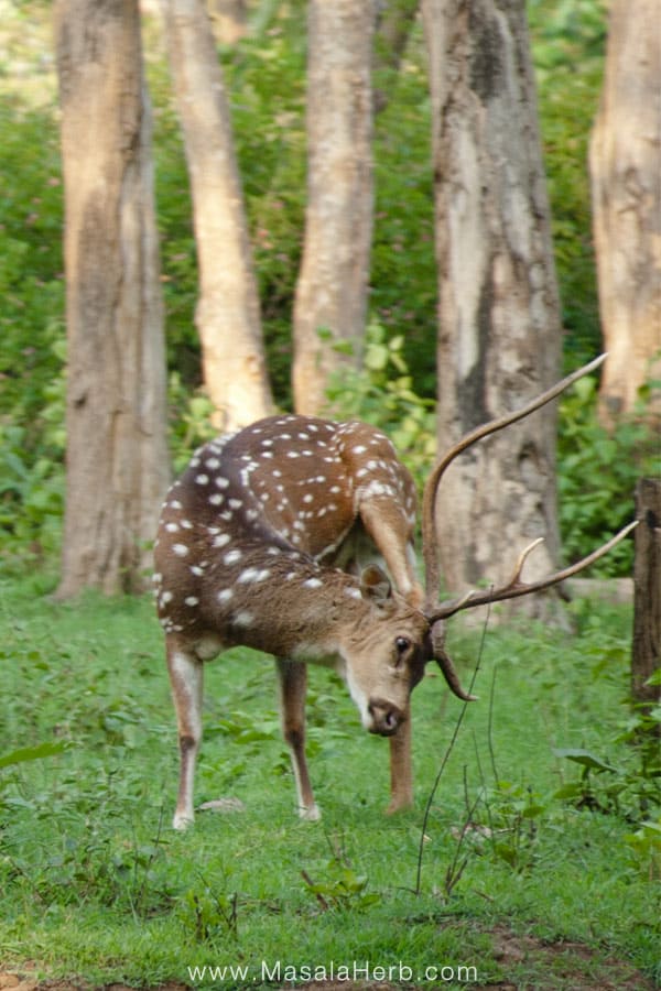
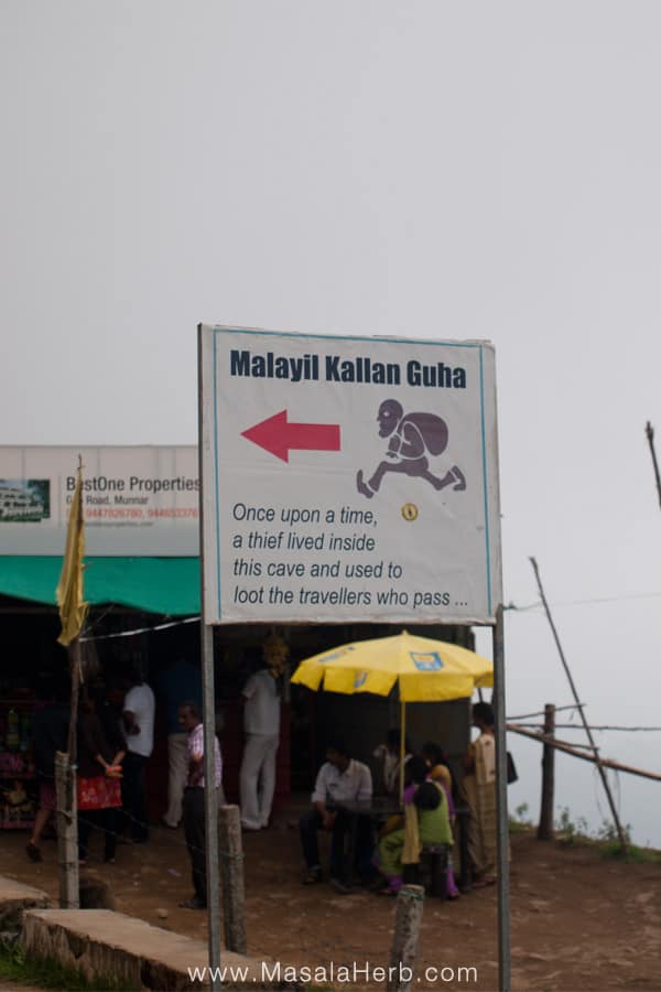
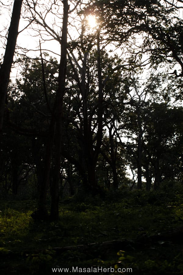
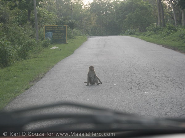
- You will be driving through the National Parks, which is a highlight of the trip. You will come across wild elephants, deers and of course monkeys. While driving through the Parks, you are not allowed to stop the car and you are adviced to drive slow. The animals seem friendly but as a visitor please respect the rules of the park and don't harass the animals.
- The roads get worse in time once you have crossed the second national park. Some roads are completely broken, so drive slowly.
- We took about 7 hours for this route in moderate speed
Ooty to Kodaikanal route
From Ooty we continued on the NH 67 southwards, passing Connor, Mettupalayam, Annur.
Then we moved on, got to Palladam and changed to highway 171 and then SH 174A before this road merged into SH 174 and later on near Dharapuram the road changed to 83A.
At Dharapuram I picked the SH 37 towards Oddanchatram instead of the SH 153 towards Palani because Google maps was not showing SH 153 as an option and I did not want to take the risk of using a dangerous mountain road so I decided on the longer route to Kodaikanal.
You may want to move from Dharapuram to Palani and then Kodaikanal but I can't guarantee that this road is by any means save!
At Oddanchatram we changed for a short time to NH 209 before getting back to SH 37, direction South - South east, passing mostly smaller villages such as Sriramapuram and Palayakannivadi before reaching Sempatty where we changed to the Chennai Theni Highway/NH 45.
We passed Batlagundu and Kattakamanpatti. After Kattakamanpatti we took the Kodai Ghat mountain road direction Kodaikanal.
- From Ooty to after Connor you will be experiencing a cold climate, narrow mountain roads with many tough turns. You will come across a few tight villages.
- After Connor the road will start leading you downwards and the temperatures will rise slowly again.
- Once in Mettupalayam you will experience a hot tropical climate again for a few hours until you reach Kodaikanal. Kodaikanal is cold, the Kodai valleys surrounding the city are half tropical.
- The road from Mettupalayam until Dharapuram is straight, in good condition and fairly large. The land itself is very flat and you can see the Western Ghats mountains from afar.
- Once in Dharapuram make sure to use GPS and ask locals for directions because it's a crazy city with lots of traffic, confusing bypass roads and a whole lots of one way roads. Google maps doesn't recognize one way roads.
- From Dharapuram, Oddanchatram until Kattakamanpatti the roads are straight and you might not come across many villages or people so best is to use GPS.
- For a short stretch before taking the mountain highway from Kattakamanpatti onwards you will be using a new elevated super cool fast Highway.
- The mountain highway 156 to Kodaikanal will be long, tight and full of heavy turns but the road condition is great. The temperatures will drop a lot too.
- We took about 11 hours for the Ooty to Kodaikanal route
Kodaikanal to Munnar route
From Kodaikanal we drove down the Kodai Ghat mountain road until we reached near Kattakamanpatti again and picked the Chennai Theni Highway/NH 45 direction Theni.
crossed Periyakulam before reaching Theni. Right after Theni city we turned into NH 49 and continued, crossing Bodinayakanur.
We stayed on the NH 49 and crossed the mountain roads, passed Chinakannal before reaching Munnar.
- After having take the kodaikanal mountain road back down, moving towards Kattakamanpatti until Bodinayakanur you will experience good highway conditions.
- After Bodinayakanur you will have the feeling of being away from the civilization and you will get to the mountain highway 49 which is a broken highway, but it's being fixed by the government.
- Highway 49 was quite a ride but the view and peace made it absolutely worthwhile. You will not see much traffic here and at some point you will be crossing from Tamil Nadu state to Kerala state.
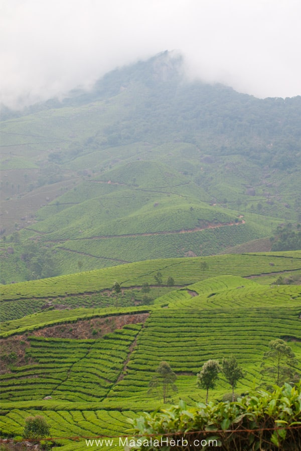
- Around Chinakannal you will notice that the roads lead frequently upwards and then downwards again and again and soon you will be amazed by the beautiful tea gardens.
- The tea garden landscape will continue for some time until Munnar (and even after!), and sometimes you will come across thick fog, so drive slowly.
- The temperatures in and around Munnar are medium cold.
- We took around 7 hours for the Kodaikanal to Munnar route in moderate and quick speed.
Munnar to Kochi route
From Munnar we continued south, Kochi direction, with the NH 49.
We passed Adimali, Kothamangalam, Kolenchery and then got to Kochi.
- The road around Munnar is being fixed, it can get quite dusty at times.
- The mountain highway, which I feel should just be called a regular road, from Munnar to Kothamangalam is mostly in a very good condition but it's rather narrow and has many heavy turns.
- Once you have left the mountain range you will notice that it gets significantly hotter.
- The rest of the highway until Kochi is very easy to follow and the road is in a good shape but narrow at times.
- You might get into traffic around Kochi but the roads in this city are the easiest to follow. I think so Kochi is one of those few exceptions in India where you feel you are not in India.
- We took around 5 hours for the Munnar to Kochi route in good speed.
Kochi to Alappuzha route
From Kochi we picked the direct coastal NH 47 to Alappuzha, direction Thiruvananthapuram. We used the same route back to Kochi.
- Gorgeous straight and large coastal highway (for India) with a beautiful landscape
- The weather will be hot
- You will cross a toll booth after Kochi city. I believe the price to cross is around 20 INR if i remember correctly.
- We decided to go to Alappuzha to rent one of those famous Kerala channel river boats. We ended up looking and discussing rates for the countless boats there, but unfortunately, due to the fact that we felt cheated, and because of the worst pressing heat that I have ever experienced, we left already after having spend an 1 hour there and drove back towards Kochi and continued in the afternoon towards Goa direction.
- We took around 1 ½ hour from Kochi to Alappuzha (and vice versa) in quick speed.
Kochi to Goa route via Calicut (also known as Kozhikode)
We moved Northwards from Kochi on the NH17, passing Calicut and Mangalore, while still remaining on the NH17 until we reached back to Goa.
- The coastal Highway NH17 from Kochi to Goa was the worst road ever. Traffic is thick and slow, it's very hot, the roads are narrow and you will barely recognize this highway as one.
- We stopped, took two rooms, slept for a few hours in Calicut (Kozhikode) before we moved on to Goa at 3 am the next day.
- Calicut city itself is full of one way roads which are not clearly shown in Google Maps.
- From Calicut onwards, the roads turned out better and more organized but you will pay frequently toll. We drove mostly in the night, so the traffic was less, the roads were mostly marked with reflectors and the center of the road had frequently barriers, which are not always marked with reflectors (!). Also, we encountered many trucks at night and petrol pumps.
- Near the border of Kerala, around Uppala Gate village town, the highway turned into a complete fire red mud road with mud hills around the highway. It was the worst highway I have ever seen. I believe the government is fixing this part of NH17 highway but it will take some time. This road continued until Ullal.
- At Ullal we ended up in a massive traffic jam due to road works. This is a village before Mangalore city (also known as Mangaluru) and right before the state border where you will be crossing from Kerala state to Karnataka state
- The highway from Mangalore onwards, splits sometimes into a two lane one way system. I suppose this is new so at the time when we were using those strange two lane highway parts there were no rules. People were driving anyhow and it was at times confusing and also dangerous.
- The coastal highway part between Mangalore and Honnavar is in ok condition. At times it can be bouncy and more narrow.
- From Honnavar to Goa has been explained and covered here.
- Altogether we took a staggering 22 hours on the Kochi to Goa route and mostly in a slow pace but sometimes when we had clear field we were quite speedy.
Traveling South India tips
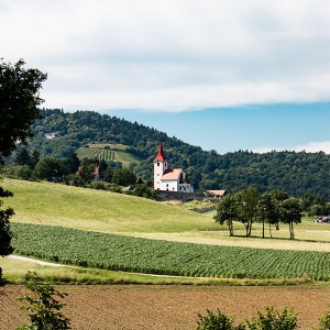
I feel the best roads and the most interesting landscapes were in Karnataka and Tamil Nadu.
We were completely surprised by the road experience in Karnataka and even doubted for a moment that we were still traveling in India, it looked like Europe.
The road stretch in Kerala was just tedious and long, except Munnar, Munnar was a wonderful green dream.
Vehicles in Karnataka and Tamil Nadu are at times reckless and fast due to the fact that the roads are kind of perfectly straight and smooth.
The mountain roads are tricky and non experienced drivers will have a hell of a time due to the road conditions or the narrow dangerous turns or other reckless drivers.
We have seen trucks and buses overtaking other big vehicles on narrow turns... Monkeys are common on the Mountain roads, so another reason to take it easy with the speed.
Read and learn more about driving in India.
The road sides in South India are clean.
With that I mean to say that we rarely saw garbage dumps, the organization of the south Indian governments seems to work well.
We saw small garbage burning circles on the road side all over Tamil Nadu and a "Go Green Initiative" booth while coming down from Ooty.
Petrol Pumps are very common along the roads all over South India.
Only the mountain areas will naturally have less petrol pumps.
most Petrol Pumps are massive and a few are open in the night too.
If you need to go to the bathroom, go at a Petrol Pump.
You won't find Petrol pump shops to buy food, drinks and other things.
It's just not common.
We definitely had fun traveling south India, it was a great adventure.
I will be sharing more soon and that will include Mysore - the Imperial city, Kodaikanal - The city in the mountains and Munnar - the Tea Garden paradise.
The traveler and dreamer in you is invited to stay amazed, I am going to take you on a beautiful ride.
If you have traveled any of the road routes mentioned above and some changes have happened, please let us know via a comment further down.

Global Food Recipes
with Spices and Herbs
Free E-Book available for a limited time. Grab yours now and get instantly inspired!
You missed out!